.png)
We've moved into a phase of weather with limited connection to tropical moisture, an ending Negative Indian Ocean Dipole, and a weak La Nina - so the significant rain systems of the past few months are less likely for now.
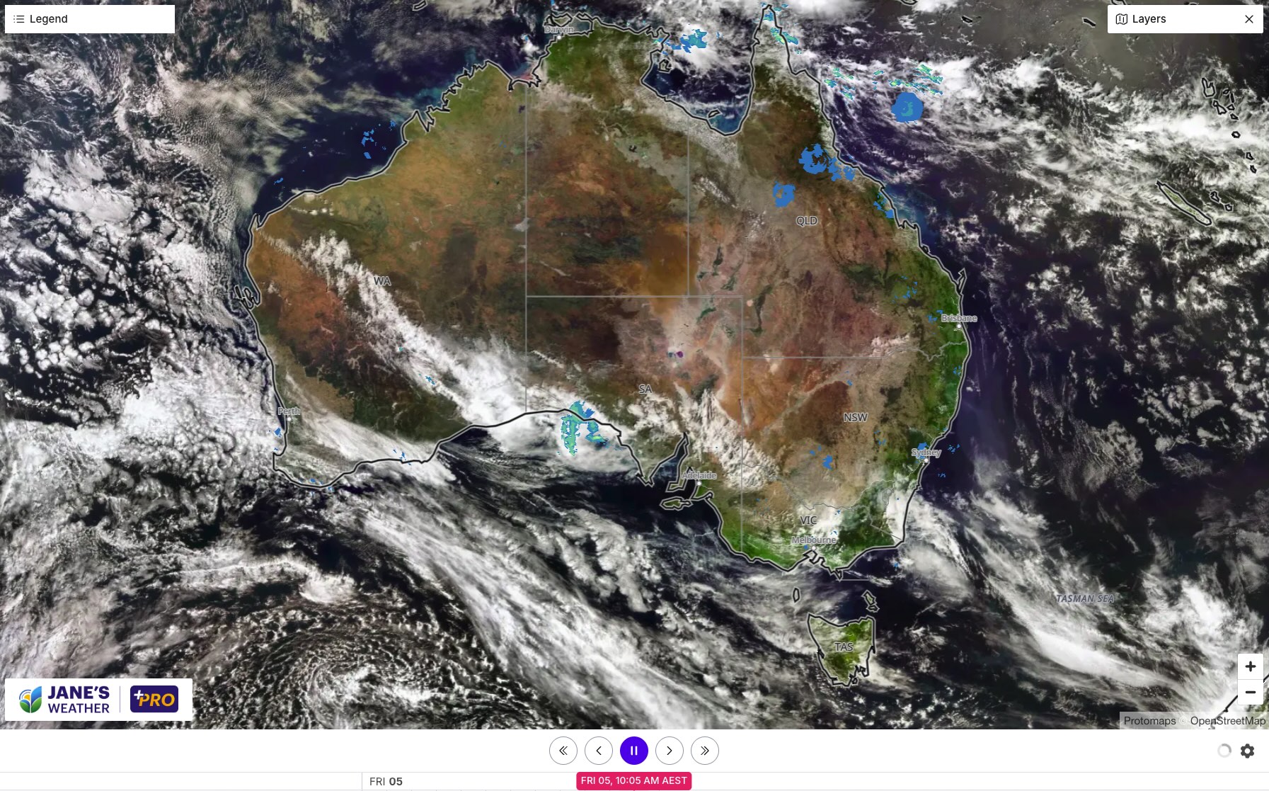
That is highlighted in this morning's satellite image which shows the vast majority of the country cloud free. Heatwave conditions are prevalent across the north and dipping down into the southeast, set to slowly retreat northwards in the east across the weekend.
Yet another cold outbreak reaches the southeast on Saturday, quickly thawing into early next week. Wet weather increases on Sunday in Queensland and NSW and continues into Monday before a break on Tuesday. Then it may pick up again there from Wednesday onwards.

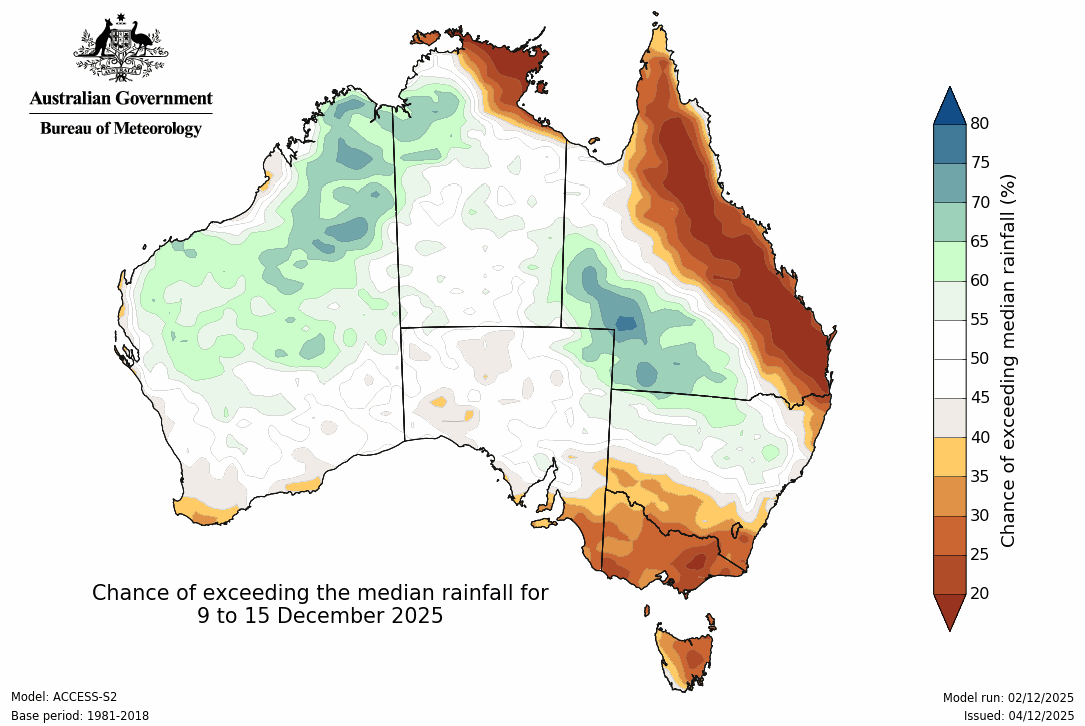
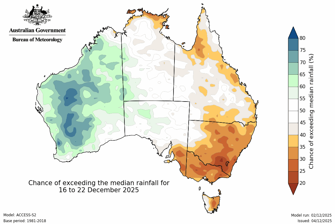
Looking longer term, and there is an area of rain possible over inland Queensland and northern NSW (from Wednesday next week), otherwise things are looking on the dry side in the east. The activity focuses on the northwest, and may spread down into the southwest in the week beginning December 16th - while all parts of the east look quite dry.
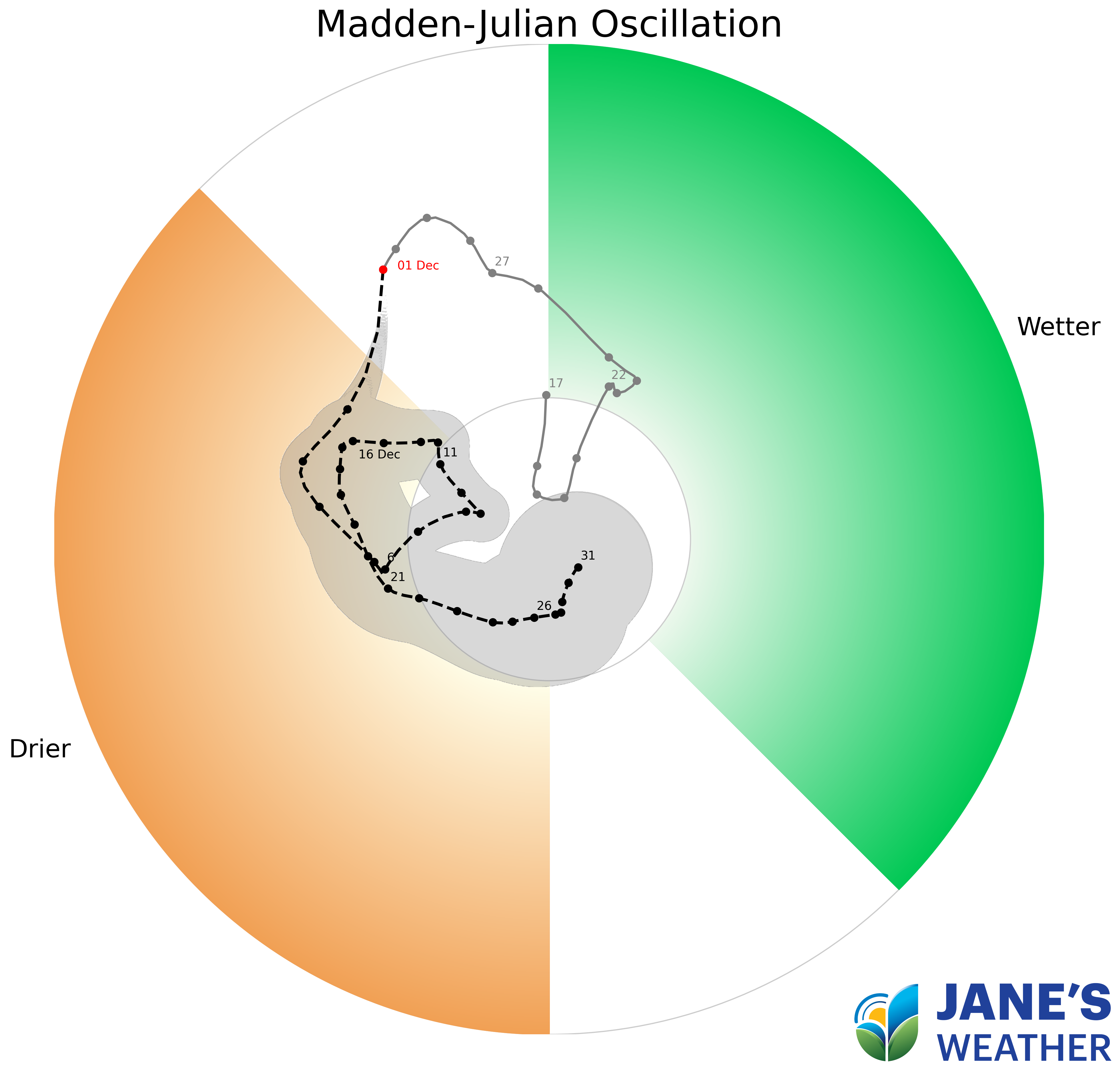
One of the instigators for this lack of tropical connection is a climate driver known as the Madden-Julian Oscillation (MJO). This pulse of energy travels around the globe at the tropics, creating activity where it passes, and suppressing activity on the other side of the world. For December this pulse is taking a holiday away from Australia, which is why our weather patterns have changed. We still have a weak La Nina, but we need something to get that going to see the big rainfalls from it - and for the next few weeks we don't seem to have that connection.
In this series I'll take you through the drivers of our weather, highlighting any changes over time and things to watch out for (generally every Sunday). It covers weather elements like temperature and rainfall, and how they are driven by moisture from the Pacific and Indian Oceans, as well as bursts of energy from low pressure (SAM and MJO).
See and hear my commentary as I take you through the weather pattern's effects on our rain and temperatures in detail over the next week, with a brief look at week 2 and beyond as well.
Plus what is driving our weather in the weeks and months ahead, with the latest on El Nino/La Nina, the Indian Ocean Dipole (IOD), the Southern Annular Mode (SAM controls our weather systems), and the Madden Julian Oscillation (MJO connects tropical moisture to our weather systems).
I update this commentary each week, generally on Sundays. Make sure you are signed up (free or a subscription) so you don't miss an update.
Stay up to date with the forecast specifically for your area in our hour by hour outlook for the next 10 days. Download our app for iPhone and Android.
As always, you can see each of these graphics as soon as they update, as well as more information about them under our Rain Outlook and Seasonal Outlook pages within Jane's Update, along with our Snow Forecast in the snow season.

For further insights specifically for agriculture, to improve the utilisation of your resources, tailored to any Australian location, please upgrade your membership. You can take advantage of our free 30 day trial.
Upgrade to see full insights to help plan the best use for your resources:
- frost risk
- spraying conditions
- evapotranspiration to efficiently manage available water for crops
- growing degree days to monitor growth
- full ten day hour by hour outlooks, all variables, and all model data
- customised alert notifications
.png)
.png)
.png)